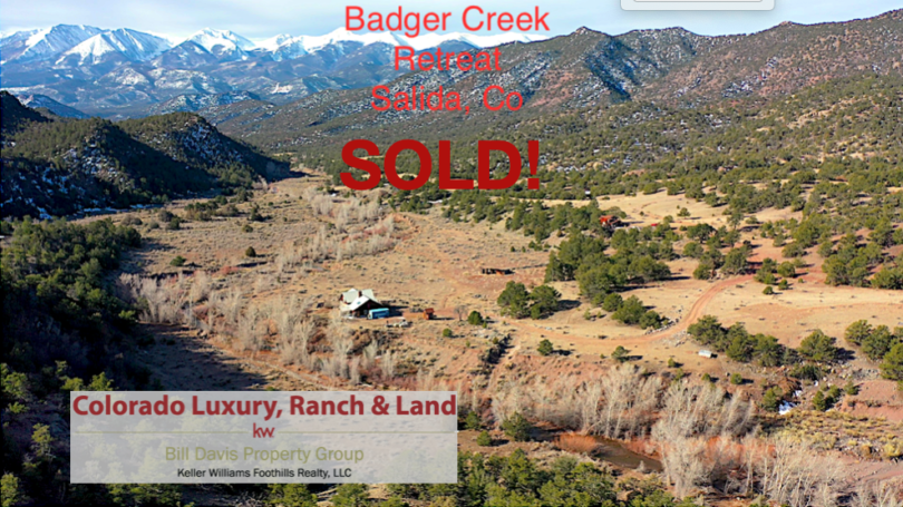
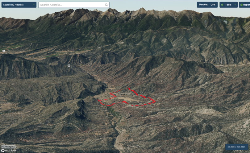
Property Details & Maps
The Badger Creek Recreational Retreat is located in Freemont County just over 9 miles as the crow flies East of the mountain community of Salida, Colorado. The property sets an an altitude of approximately 7200′ and is about 2 3/4 hours from the Colorado Springs airport or 3 1/2 hours from the Denver metropolitan area.
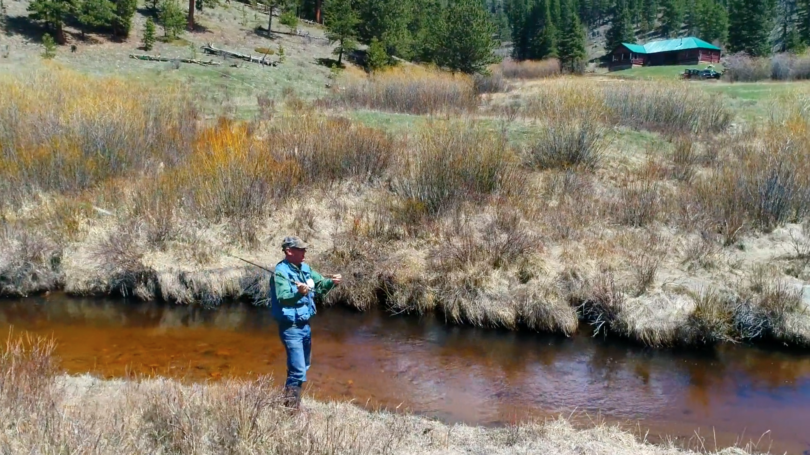
Consisting of plus/minus 149.68 Acres zoned AF (Agricultural Forestry) within Freemont County, Colorado; the property is surrounded by Bureau of Land Managment (BLM) public lands. It is a cumulation of 4, roughly 37.5 acre non-severable parcels (lots 1 through 4). With the property situated roughly 5.5 miles from the pavement of Hwy 50 at Wellsville, the primary access travels across several dirt roads that are accessible year-round but not maintained during the winter by any public entity. About 1/3rd mile of Badger Creek flows through the property and is a tributary to the Arkansas River just 3miles down stream.
MapRight Interactive-zoom in/out and Hover over elements or “View Full Screen” for additional information. Use “3D” Button in lower right corner and drag your mouse around while holding the control key for additional perspectives to rotate, tilt, zoom, etc.
Public Lands Map

The Sangre de Cristo Mountains hosting 4 of Colorado’s 14ers provide a stunning and dramatic backdrop to the outstanding view corridors from the property


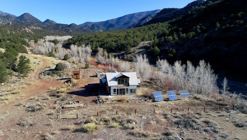
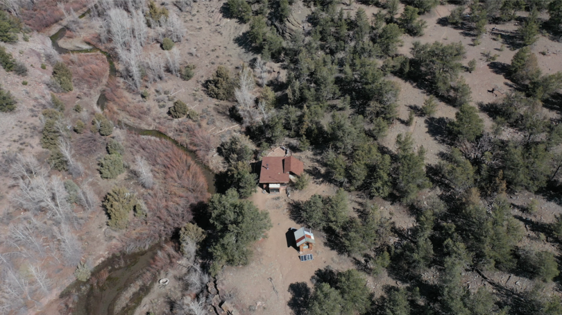
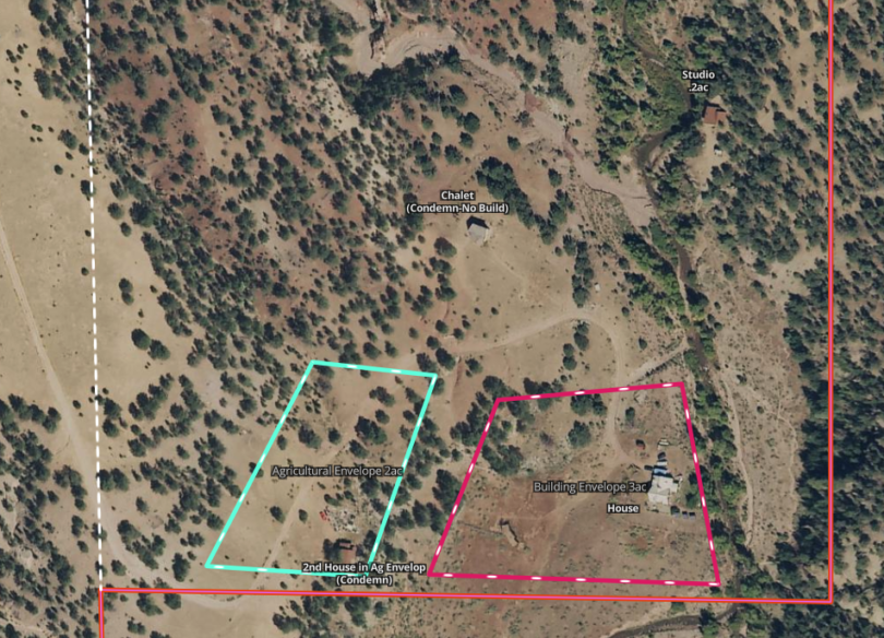
The majority of the improvements lie within the area identified as “parcel 3”. The Main House lies within a Building Envelope defined by the CE as 3 acres which contain the existing home, garden area, and loafing shed. This area can be further developed or redeveloped per the CE in to a larger home or even additional dwelling unit. A second cabin structure in extreme disrepair exists within the 2 acre Agricultural Envelope which per the CE allows for a barn or other outbuilding which may contain an additional dwelling unit as part of the structure. The existing Studio Building along the creek is allowed per the CE and has been assigned a building envelope of .2 acre. The Chalet building, although not required to be removed may not be utilized or occupied.
The improvements are supported by an interconnected water system including a 2800 gal cistern above the agricultural envelope and 1800 gal cistern at the Chalet. The main residence and hydrants are supplied via a gravity pressurized pipeline. The Domestic Well (see documents section) has the ability to fill either or both cisterns at a leisurely pace to work efficiently from the solar system.
The property is primarily accessed from where the well maintained County Road 7/45 intersects Hwy 50 at Wellsville for about .9 mi and then turning north on to the nicely graded County Road 53 for another 1.4 mi. There at the quarry gate the route follows the publicly accessible “Powerline Road” (US Forest Service Rd 5965) for roughly 3 miles to the property boundary. This high-clearance 4WD road is periodically maintained by the BLM and/or the power company (no winter maintenance) which maintains access to their transmission lines along the corridor. Beyond the property the Powerline Road intersects BLM Rd 5980 which connects through to the town of Howard. The owners of the Badger Creek property as part of their rights of access have the right to make improvements to this roadway and/or further maintain it.