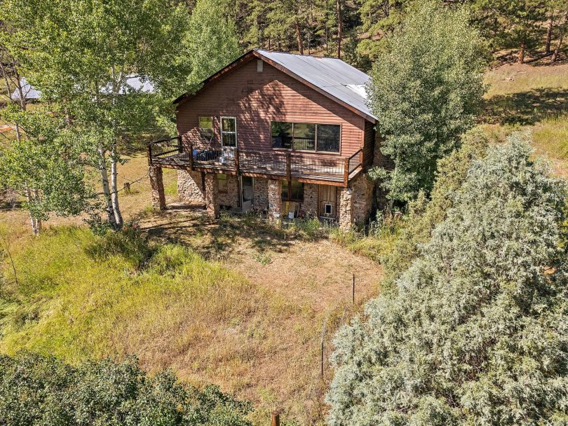
Property Details & Maps
Tucked in to the foothill mountains along the Golden Gate Canyon corridor 14 miles west of downtown Golden, the property is a private forested sanctuary within close striking distance from urban conveniences. Year-round access to Denver, Boulder and surrounding communities including the historic attractions of Black Hawk, Central City and the Scenic Peak to Peak Highway. The property lies about 48 miles from Denver International Airport.
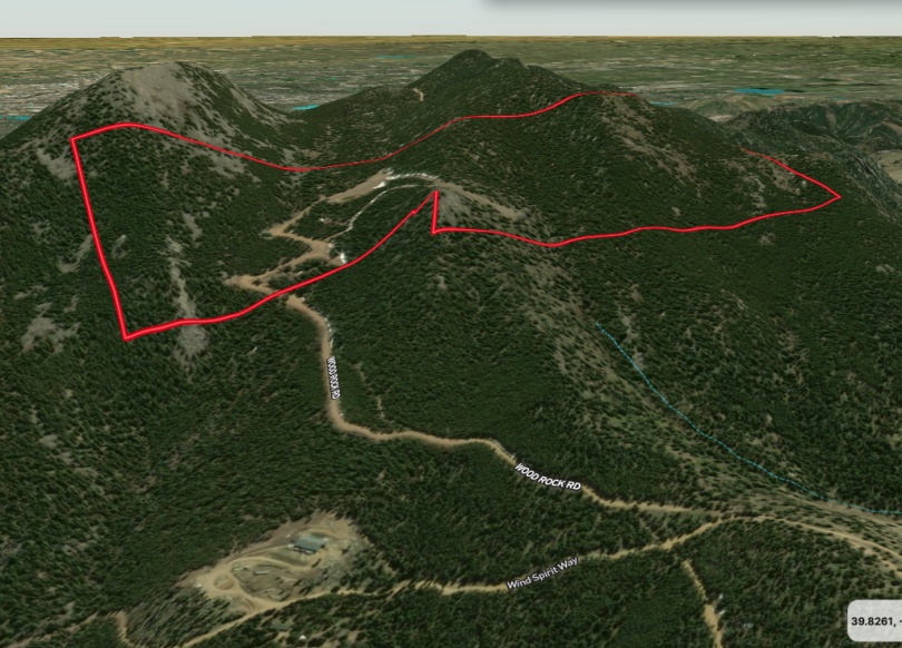
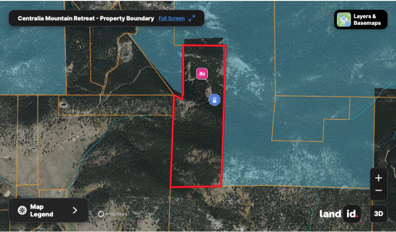
Consisting of roughly 105.434 Acres zoned A-2 (Agricultural) within Jefferson County, Colorado; the property is adjacent to the Ralston Creek State Wildlife Area and the Golden Gate Canyon State Park beyond with over 14,219 acres of public lands.
MapRight Interactive-zoom in/out and Hover over elements or “View Full Screen” for additional information. Use “3D” Button in lower right corner and drag your mouse around while holding the control key for additional perspectives to rotate, tilt, zoom, etc.
Public Lands Map
The property is adjacent to public lands on multiple sides and the region is host to a variety of State and Regional Parks as well as Arapaho & Roosevelt National Forests all of which provide tremendous access for recreational opportunities including fishing, hiking & mountain biking, horseback riding and hunting. The Property lies within Game Management Unit 38

The property lies between around 9000-9700′ in elevation and is a mixture of forested slopes and rocky outlooks