Property Details & Maps
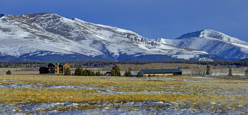
The Ranch On Fourmile Creek lies at the eastern foot of the Mosquito Range and northwestern edge of the grassland basin know as South Park in Park County Colorado just outside the mountain town of Fairplay. The ranch is 85 miles southwest of Denver or equally northwest of Colorado Springs and is just 25 miles south of the resort mountain and ski town of Breckenridge.
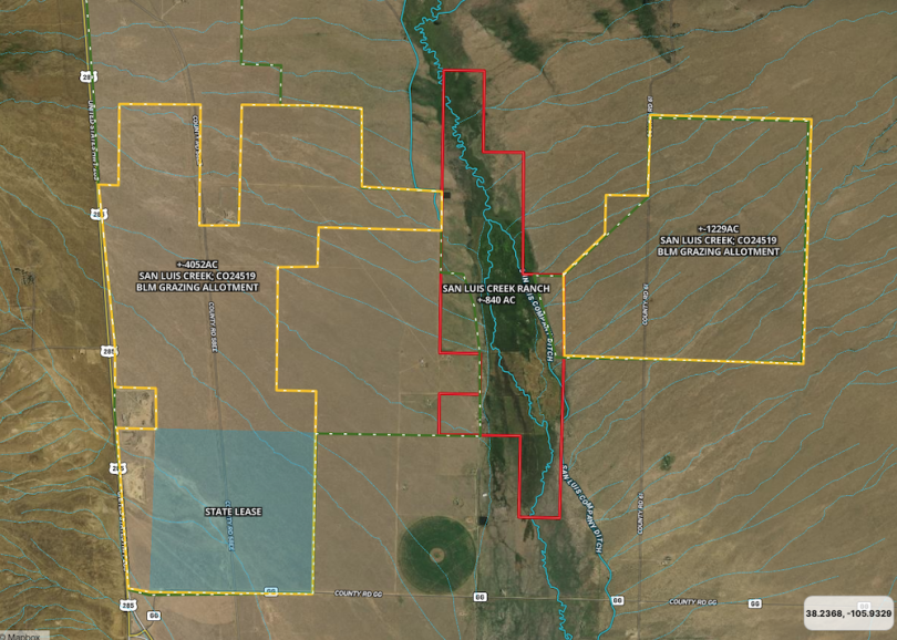
The property consists of 2012 deeded acres just south of the town of Fairplay off Hwy 285. The Warm Springs Allotment BLM Grazing Lease which may be transferable to an eligible buyer consists of an estimated 1720 acres lying between the deeded parcels. Another 355 acres under lease and adjacent to the west owned by The Nature Conservancy too may be transferable to an eligible buyer. The TNC lease currently has some minor water rights to distribute flows from the Warm Springs ditch and enhance grass growth. Just west of the northern deeded parcel is the Fourmile Creek at Peart allotment of the Colorado State Land Board consisting of 960 acres. The ranch currently enjoys the grazing lease upon these lands which may be assignable (see below).
Note: This transaction may also include the assignment of a 960 acre agricultural and/or recreation lease with the Colorado State Board of Land Commissioners. Seller is not authorized to assign the lease without the review and approval of the proposed assignment by the State Land Board; approval may be withheld in the State Land Board’s sole discretion. Should a buyer wish to procure the lease, seller agrees to submit the necessary paperwork to the State Land Board to begin the lease assignment review process.


Use the MapRight Interactive mapping below to zoom in/out and Hover over elements or “View Full Screen” for additional information. Use “3D” Button in lower right and then hold “control” while clicking and dragging to gain additional perspectives, topography, and views.
(Note access permitted by appointment only and must be accompanied by Broker)
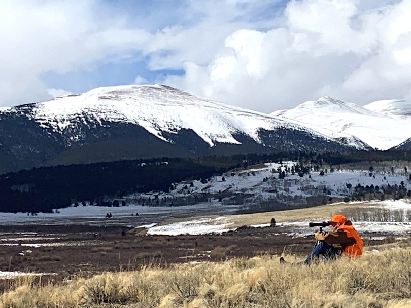
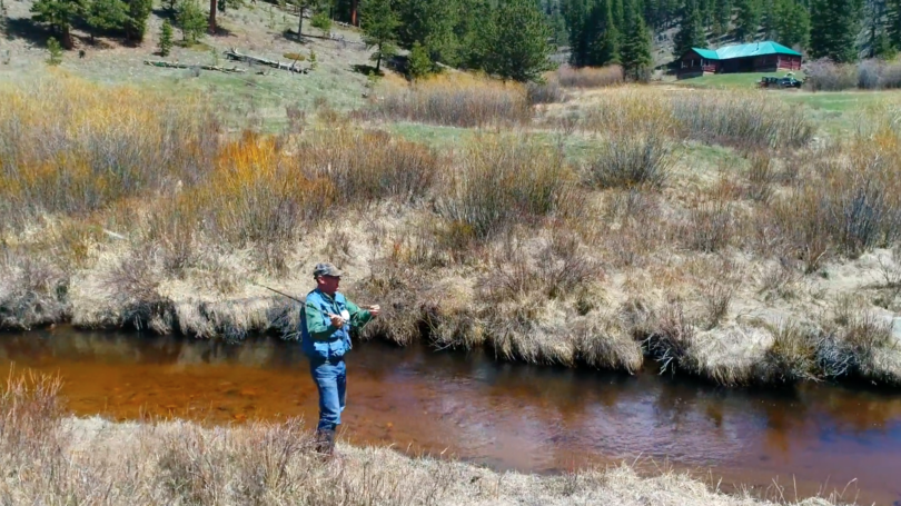
The area is surrounded by a myriad of literally thousands of acres of public lands including BLM (yellow), State Land trusts (blue) and National Forest (green) with access to trails, lakes & streams, hunting & fishing and endless summer and winter recreational opportunities in all directions.

The property is fenced and crossed fenced to a multitude of pasture and grazing segments. The headquarters parcel is accessed from Hwy 285 and the southern parcel has portions off Hwy 285 and is bisected by County Road 5 traversing towards Weston Pass which can be traversed in summertime to Leadville.
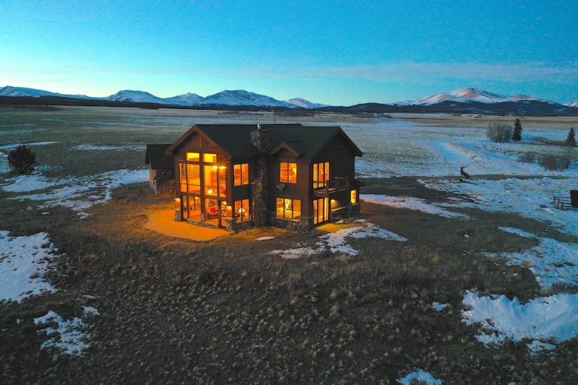
Improvements upon the property are required to be within a 10 acre building envelope upon the northern 682 portion of the ranch where the existing home and barn currently lie. One additional residence could be built within this envelope (refer to Hart Ranch II conservation easement pg 4; section 4,B,(1)a etc). An additional 10,000 cumulative square feet of non-residential improvements may be maintained.